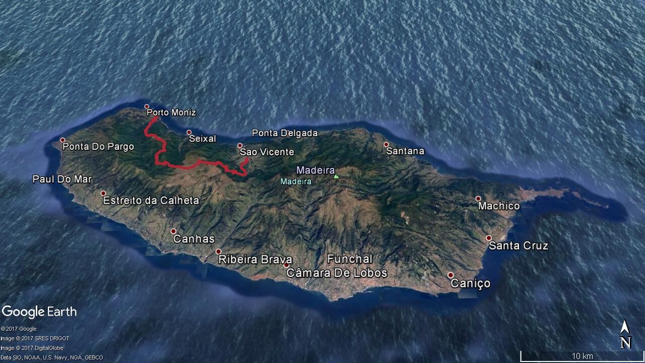
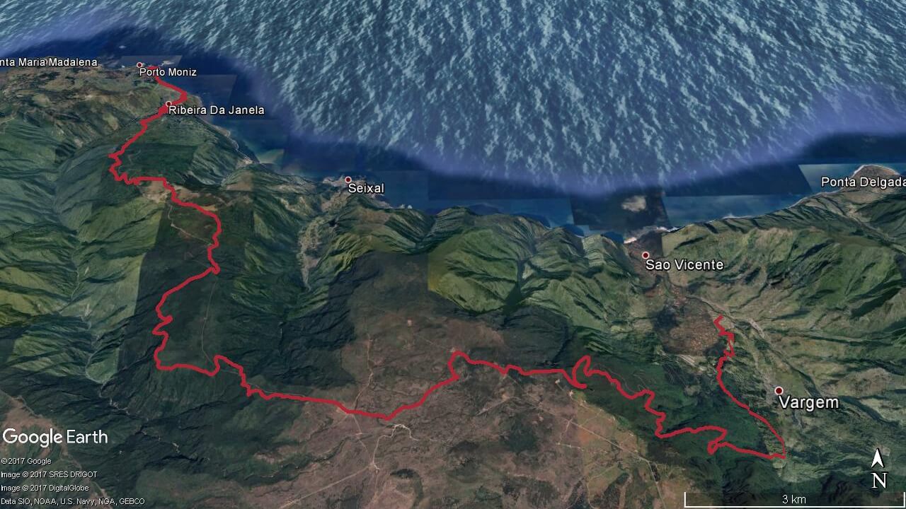
SAO VICENTE TRAIL RUNNING TOUR
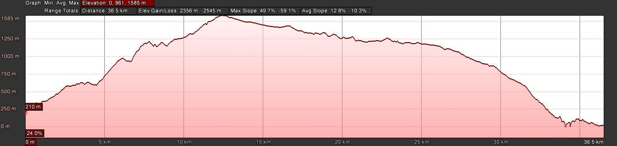
Elevation gain 2356 m | Distance 36.5 km | Altitude min. 0 m | Altitude max. 1585 mSao Vicente trail running tour route
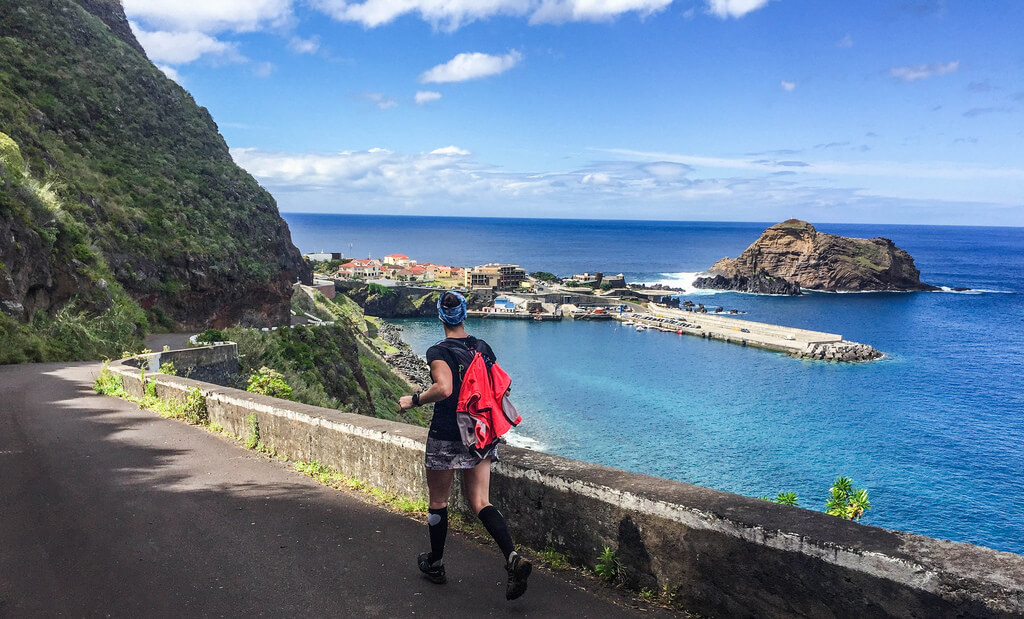
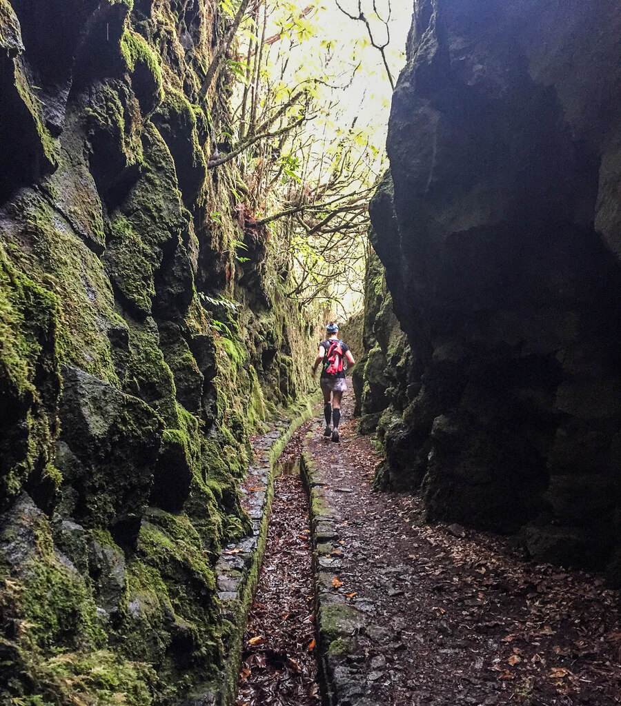
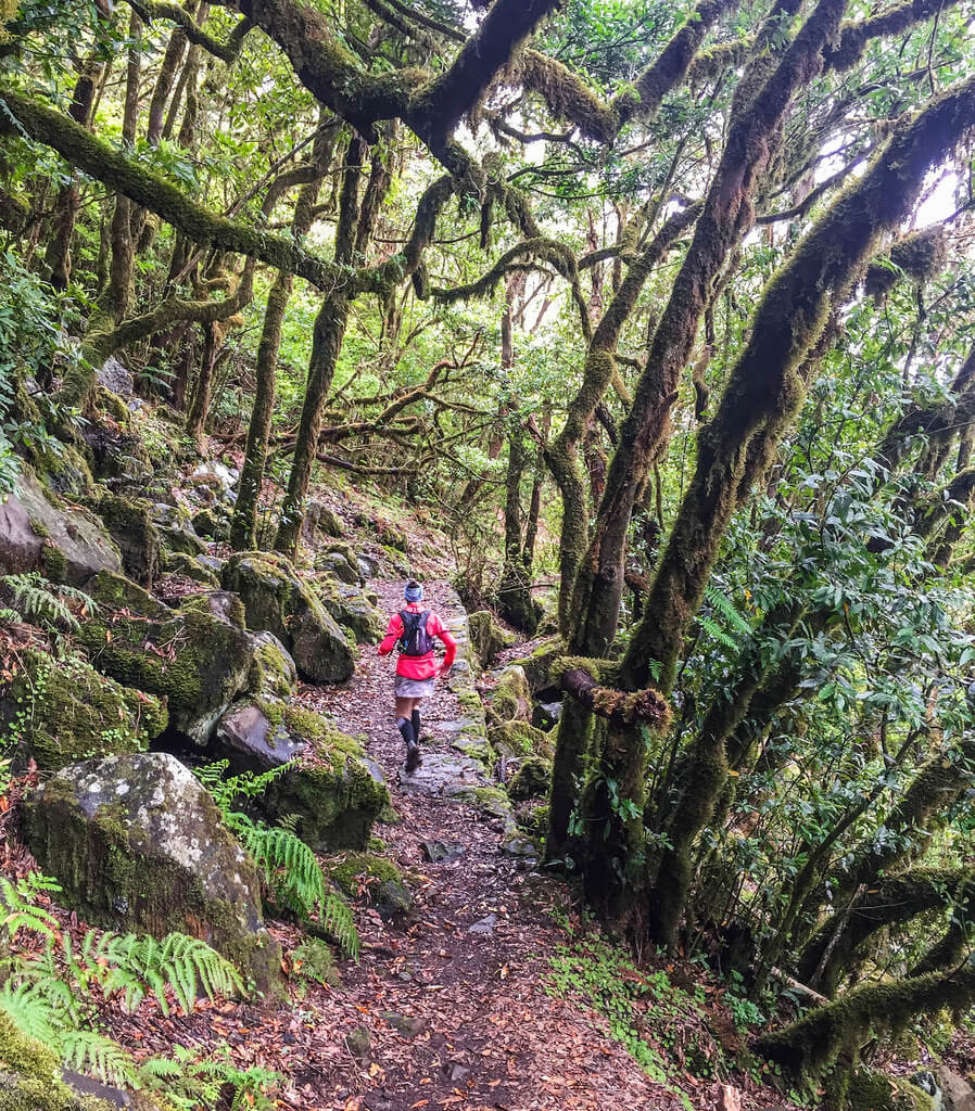
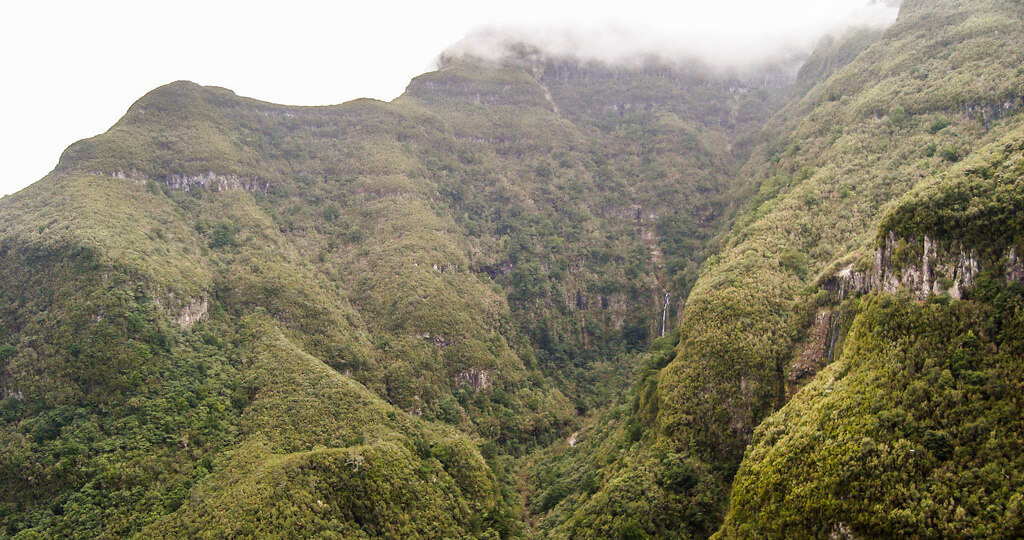
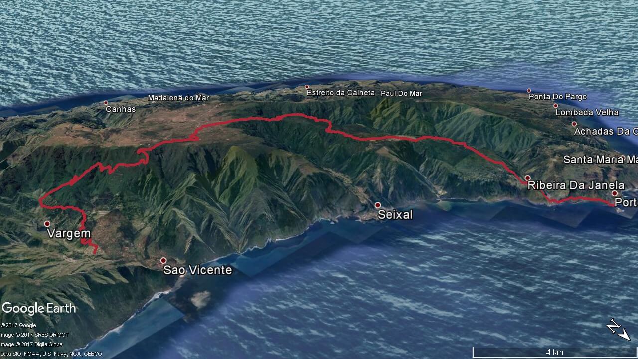
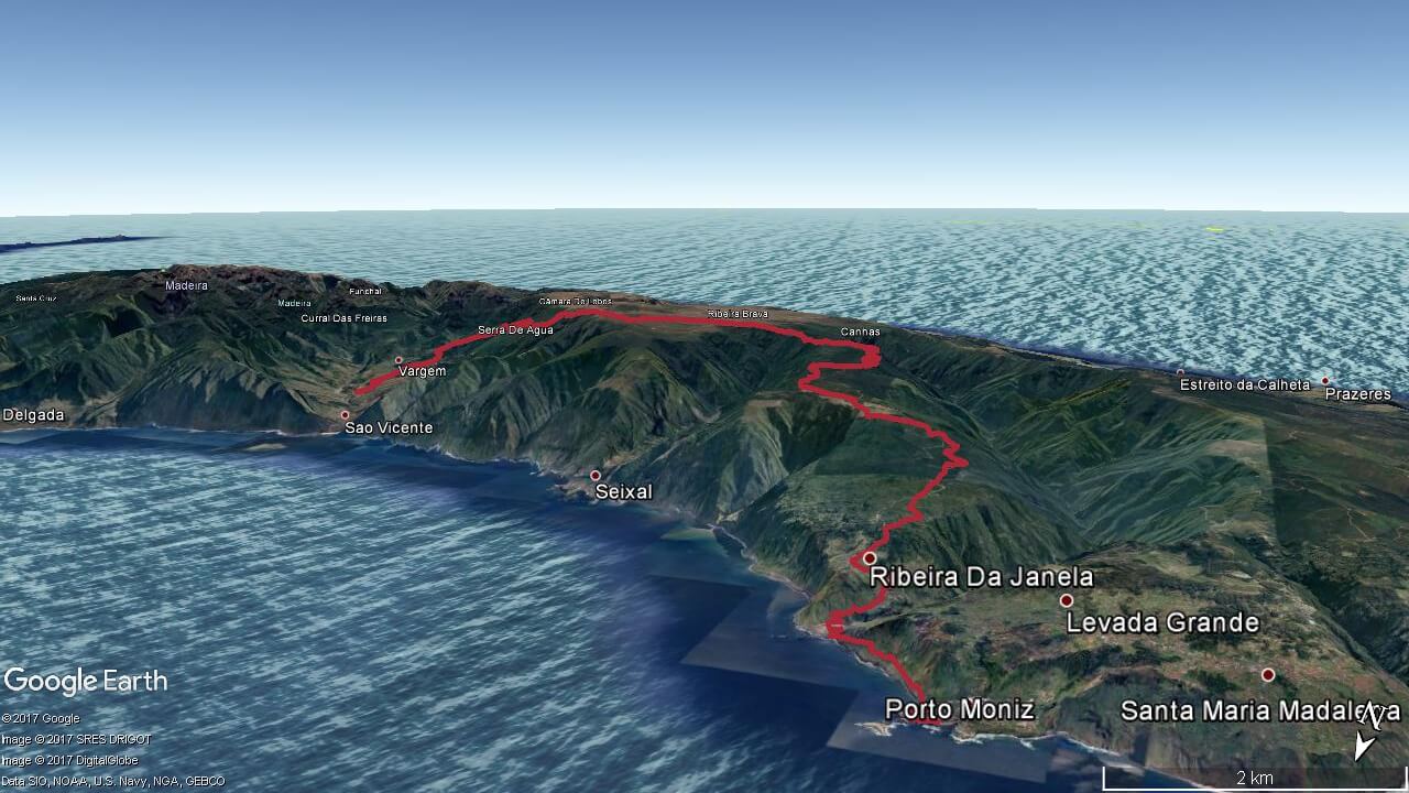
São Vicente – Levada do Rodrigues – Amazónia – Folhadal – Caramujo – Estanquinhos – Assobiadouros – Fanal – Curral Falso – Ribeira da Janela – Porto Moniz
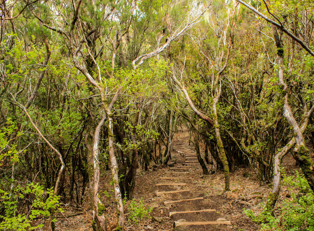
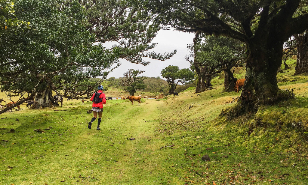
Starting in the centre of São Vicente, we run uphill to a narrow levada, going further along a dirt road in the area of Ginjas, we climb up to get on a trail heading to levada Fajã do Rodrigues, we follow it until we reach the access road to levada in Achada do Loural. Here we go up a trail in Folhadal inside the laurel forest. Coming to Levada do Norte, we go right following this levada, until we reach the stairs to Paredão. This rise has more than 200 wooden steps, and requires some muscular endurance. After ascending we are in the heart of the laurel forest, surrounded by green hills with fantastic panoramic views of the São Vicente valley. After that, we continue our run towards Caramujo. Upon arriving at the dirt road of Ginjas, we go up until we reach the Estanquinhos forest house. Here we follow a dirt road which leads to the plateau of Paúl da Serra, until we reach place of Pocinhas where we find the Fanal road. We take the road for a few tens of meters to enter then the path of Fanal. where for about 11 km we enjoy fabulous views on the Rabaçal, the Ribeira da Janela, and the Chão da Ribeira. Passing by Fanal, we go down by a technical trail crossing some dirt roads, then taking the final part of the path towards Ribeira da Janela. From Ribeira da Janela, we run by the former regional road, to the village of Porto Moniz.
Elevation gain (m)
Distance (km)
Altitude min. (m)
Altitude max. (m)


Map, route, elevation
Prices
Sao Vicente Trail Running
- Activity duration 7 hours
- Pick up from hotel
- Trail running with guide
- Insurance
- Thermal blanket and whistle
- Flashlight
- Water and 2 snack bars
- Drop off at hotel
- *Min. 2 persons
Sao Vicente Trail Running Individual
- Activity duration 7 hours
- Pick up from hotel
- Trail running with guide
- Insurance
- Thermal blanket and whistle
- Flashlight
- Water and 2 snack bars
- Drop off at hotel